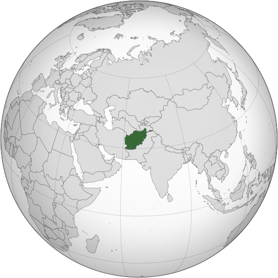
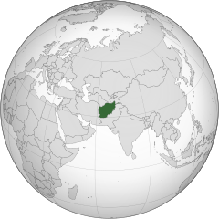
ไฟล์:Afghanistan (orthographic projection).svg

ขนาดของตัวอย่าง PNG นี้ของไฟล์ SVG นี้: 553 × 553 พิกเซล ความละเอียดอื่น: 240 × 240 พิกเซล | 480 × 480 พิกเซล | 768 × 768 พิกเซล | 1,024 × 1,024 พิกเซล | 2,048 × 2,048 พิกเซล
ไฟล์ต้นฉบับ (ไฟล์ SVG ขนาดประมาณ 553 × 553 พิกเซล, ขนาดไฟล์: 298 กิโลไบต์)
.svg)
ความย่อ
| คำอธิบาย |
اردو: طرحی متعامد از افغانستان |
| วันที่ | |
| แหล่งที่มา | Own work based on: India (orthographic projection).svg โดย Ssolbergj |
| ผู้สร้างสรรค์ | Shahid Parvez |
| SVG genesis | ซอร์สโค้ดของ SVG นี้ตรวจสอบถูกต้องแล้ว . ไฟล์ภาพกราฟิกส์เวกเตอร์นี้ สร้างขึ้นโดยใช้ Other tools |
.svg)
การอนุญาตใช้สิทธิ
The map has been created with the Generic Mapping Tools: https://www.generic-mapping-tools.org/ using one or more of these public-domain datasets for the relief:
|

|
อนุญาตให้คัดลอก แจกจ่ายและ/หรือดัดแปรเอกสารนี้ภายใต้เงื่อนไขของสัญญาอนุญาตเอกสารเสรีของกนู รุ่น 1.2 หรือรุ่นใด ๆ นับจากนี้ที่ออกโดยมูลนิธิซอฟต์แวร์เสรี โดยไม่มีส่วนใดห้ามแก้ไข ไม่มีข้อความปกหน้าและปกหลัง สำเนาของสัญญาอนุญาตรวมอยู่ในส่วนชื่อ สัญญาอนุญาตเอกสารเสรีของกนู |
บันทึกการอัพโหลด
นำเข้าจาก en.wikipedia มายังคอมมอนส์ โดย Cirt โดยใช้ CommonsHelper
The original description page was here. All following user names refer to en.wikipedia.
- 2009-10-05 17:28 Parvez gsm 541×541× (517730 bytes) {{Information |Description = Afghanistan orthographic_projection |Source = I have created this work entirely by myself. |Date = October 5 |Author = Shahid Parvez |other_versions = }}
ประวัติไฟล์
คลิกวันที่/เวลาเพื่อดูไฟล์ที่ปรากฏในขณะนั้น
| วันที่/เวลา | รูปย่อ | ขนาด | ผู้ใช้ | ความเห็น | |
|---|---|---|---|---|---|
| ปัจจุบัน | 14:46, 27 กรกฎาคม 2562 | | 553 × 553 (298 กิโลไบต์) | Cerebellum | Revert to prior version, please provide a source for those territorial claims |
| 10:29, 26 กรกฎาคม 2562 |  | 720 × 720 (384 กิโลไบต์) | Lakshmisreekanth | Updated color | |
| 17:00, 25 กรกฎาคม 2562 |  | 720 × 727 (397 กิโลไบต์) | Lakshmisreekanth | Added claimed regions | |
| 23:36, 16 มีนาคม 2558 |  | 553 × 553 (298 กิโลไบต์) | Flappiefh | Removed Somaliland and Kosovo. Separated Western Sahara and Morroco. | |
| 12:43, 4 สิงหาคม 2556 |  | 553 × 553 (302 กิโลไบต์) | Flappiefh | Added South Sudan. The map is now centered on Afghanistan. | |
| 22:45, 20 พฤศจิกายน 2552 |  | 541 × 541 (506 กิโลไบต์) | File Upload Bot (Magnus Manske) | {{BotMoveToCommons|en.wikipedia|year={{subst:CURRENTYEAR}}|month={{subst:CURRENTMONTHNAME}}|day={{subst:CURRENTDAY}}}} {{Information |Description={{en|Afghanistan orthographic_projection}} |Source=Transferred from [http://en.wikipedia.org en.wikipedia]; |
ลิงก์ภาพ
ไม่มีหน้าใดโยงมาที่ภาพนี้
.svg)